Main Page | Knowledge base | Geophysics | Seismic studies | Reflection seismic
REFLECTION SEISMICS
Reflection seismics allows to visualize geological structures especially from greater depths. Such measurements are based on the registration and analysis of an artificially induced and reflected waves (in contrast to the refraction seismic) from the geological boundaries. The principle of this method is similar to the GPR method, but elastic seismic waves are used.

Initially reflection seismics served as one of the tools for hydrocarbon prospecting, especially oil and natural gas. Over time, the number of different applications has grown into and at this moment this method is suitable for various applications wherever requires a thorough knowledge of the geological structure of the area, eg. salt domes, geothermal sources and detection of mineral deposits, ground stability evaluation, monitoring of exploitation.
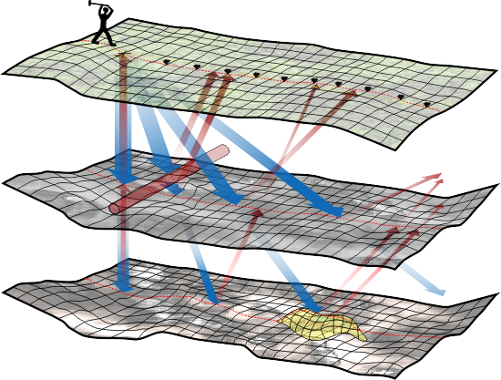
Reflection measurements base on generating seismic waves using source in shooting points, then signal is recorded by the receivers arranged on the surface at collection points. The vibrations reaching the receivers are the result of propagation and reflection of seismic waves, from the geological borders. Designing the shooting and receivers points must respect the principle of multiple coverage – for each point of reflection (CMP) should pass minimum tens of seismic rays. It aims to strengthen the signal to noise ratio.
Registration of reflections of seismic waves (using seismograph) from subsurface structures leads to the creation of hodograph which represents the time arrivals of reflected waves to the next receivers (geophones).
Using reflection method is possible if the subsurface is layered, and the layers are dipping up to 45°. Wave reflections occur in areas where layers have different acoustic impedance.
The recorded field data require complicated processing procedures before imaging of geological structure.
The seismic reflection method can be used to identify and classify:
- lithological&facial boundaries,
- layering,
- different weathering,
- bedrock
- lower below higher velocity layers,
- groundwater levels,
- fault, fracture and weak zones,
- exploitation monitoring eg. sulphur.


