OBJECTS LOCATION
GEOPHYSICAL RESEARCH FOR OBJECTS LOCATION
Engineering geophysical surveys are used, among other things, to recognize the soil for occurring in the underground facilities which can be for example the foundations, walls, slabs reinforced, unknown rooms and infrastructure, etc. The research, carried out by different methods and techniques allow to pinpoint the exact location of objects below the surface, and allow to identify their geometrical parameters. Such objects, not removed before the start of engineering earthworks, may disrupt or even suspend construction works on new projects or extensions to of existing structures. The detection of unknown objects is also very important for proper foundation of bearing elements of buildings or other facilities.
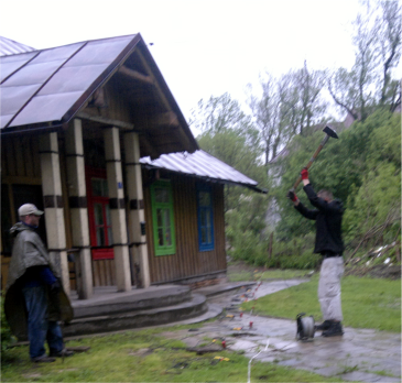
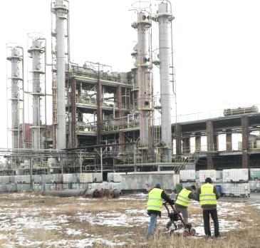
Seismic acquisition in order to search for underground rooms (chambers, tunnels) or their remains around the archaeological site (left) and GPR acquisition in the chemical plants in order to identify the old foundations remnants, unknown infrastructure and fuel tanks, performed for the new investment (right)
Most often, the following geophysical methods and techniques are used:
- GPR profiling,
- GPR mapping,
- microseismic MASW 2D profiling,
- resistivity tomography ERT 2D.
These methods are best for the location of underground facilities, but for most subsurfaces (up to a few meters) and for small objects most accurate is the GPR survey. For depth below a few meters, better results provides microseismic method.

Georadar cross section for searching for unidentified objects as chambers, cellars and corridors, located on the area adjacent to the historical buildings. On the picture there is visible a large amount of infrastructure, the remnants of foundations and localized zones indicating the re-mains of other structures below the surface
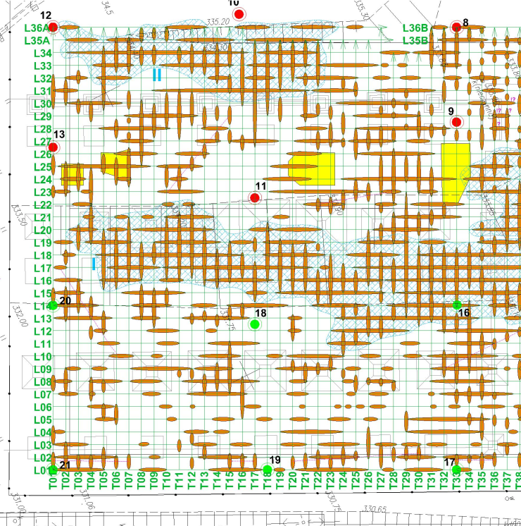
Sample map of GPR anomalies with the spatial interpretation of three-dimensional search for the remains of objects in the ground. The search was performed in the grid of profiles (green). Pointed the presence of several reinforced plates (yellow) and areas with high concentrations of debris and remains of foundations at the site of the planned investment (blue)
Non-invasive geophysical research saves time and provide high precision in detecting objects.Another branch of applications of such research is archeology for location of cellars, chambers, walls, tombs, tunnels and crypts. There are several different geophysical methods but their selection should be precisely adapted to the physical properties of the objects (eg dimensions, the material from which they are made). Presumed depth of their presence in the examined medium is also important. This allows optimization the methodology and scope of specific studies.
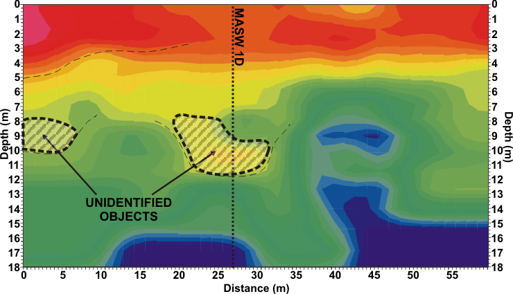
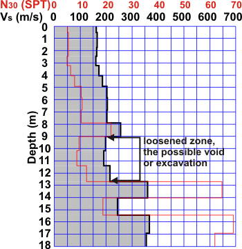
Example of interpreted seismic cross section MASW 2D (top) and seismic profile MASW 1D (right), indicating the location of zones of reduced bulk density, which can be possible location of the old tunnel.