


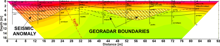
GeoSpectrum – P-wave velocity field as a result of seismic surveys done by refraction tomography method to determine the loosened zones and cracks. Ranges of landslide risk areas are marked basing on georadar boundaries. Indicated probable fault zone was confirmed by geotechnical surveys