


SERVICES
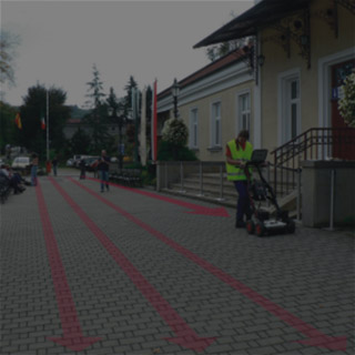
GeoSpectrum company offers wide range of geophysical services (engineering seismics, Ground Penetrating Radar, electrical resistivity, microgravimetry and electromagnetics), geological, geotechnical and environmental protection.
Geophysical surveys
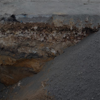
Geophysics provides non-invasive (non-destructing) exploration of the ground, it’s geomechanical parameters and structure, in the fast & cost-effective way. These methods are widely applied for solving the engineering and research tasks for many years. The proper choice of the geophysical methods helps to optimize work range of invasive geotechnical surveys.
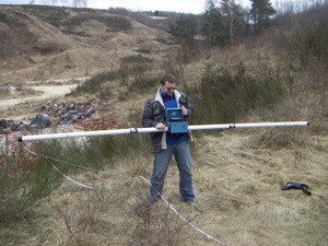
Near surface engineering seismic method:
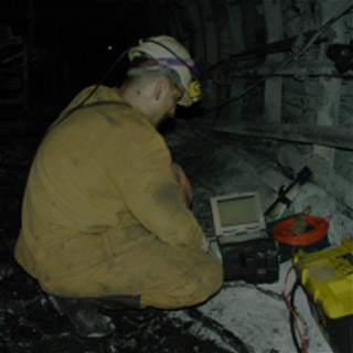
Seismic surveys using refraction, reflection, active MASW 1D/2D/3D and passive MAM/ReMi 1D, refraction tomography, cross-hole, velocity profiling, upholes techniques are commonly used to determine site geology, stratigraphy, and rock quality. These techniques provide detailed information about subsurface layering and rock geomechanical properties using seismic waves. Our staff carried out the first MASW surveys in the Poland, commonly used in the world. Currently, we are also the only company in Poland that offers specialized seismic measurements of „downhole”, „crosshole” and seismic tomography.
GPR method:
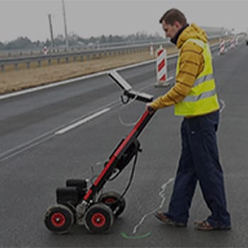
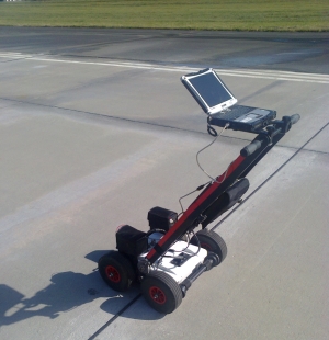
GPR surveys are carried out as reflection profiling with variable resolution and depth range i.e.: for railway revitalization, modernization or study, the flood embankments, recognition of railway track bedrock and its subsoil, recognition of the ground for the proposed and existing transport infrastructure such as roads, highways, ring roads, the analysis of the position of the water table, shallow lithological and stratigraphic analysis. We also provide an innovative GPR method for spatial 3D surface scanning technique, for the purpose of mapping underground facilities such as infrastructure and foundations and their inventory.
Resistivity method:
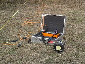
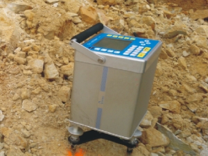
The most common geoelectric survey techniques are: Electrical Resistivity Tomography (ERT 2D – resistivity imaging), Vertical Electrical Sounding (VES 1D) and electro profiling (EP 1D). Resistivity Method using the above techniques is commonly used to determine the soil-water conditions, recognition of the geological structure in order to locate the areas of occurrence of groundwater, fault location, contouring the mineral deposits of rock and minerals.
Gravimetric method:
Gravimetric surveys are based on the variation of the gravitational field of the Earth, depending on its structure. The differences between bulk density of rocks cause changes in the distribution of gravity. This distribution depends also on the size, shape and depth of the occurrence of the heterogeneity (disrupting body). The most commonly used to assess the threat surface deformations in mining areas and for the detection of “migrating” natural and anthropogenic voids, mineral exploration, the location of faults, basements, tunnels and passages, crypts and tombs.
Electromagnetic (EM) method:
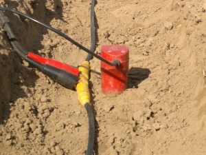
EM measurements of electromagnetic induction method in the form of dipole induction profiling rely on the study of conductivity (resistivity) of electrical subsurface layers. It is used for contouring of areas with contamination of ground water, for ground water exploration, the location of: leaks dikes, dams and canals, corrosion of pipelines, Unexploded Ordnance detection.
GeoSpectrum company performs all sorts of expertise, evaluation and research for design purposes, as-built, as well as geophysical monitoring.
Non-invasive geophysical surveys are particularly useful in:
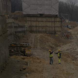
- communication infrastructure (tunnels, roads, bridges and viaducts, railways, airports), More…
- hydraulic engineering (levees, earth and concrete dams, dry flood control reservoirs, dams, weirs),
- designing: pipelines, HDD – Horizontal Directional Drilling and DD – directional drilling under rivers, terraces, roads, embankments, canals,
- cubic sized constructions (warehouses, halls),
- foundation of high and heavy objects that generate large vibrations (wind farms),
- archaeology (crypts, tombs, walls),
- underground facilities (tanks, cables, pipes),
- quality control in construction (reinforcement, foundation floors, non-invasive determination of the length / depth of burial concrete piles),
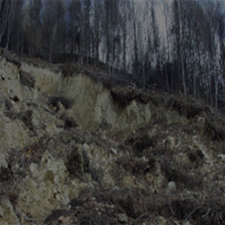
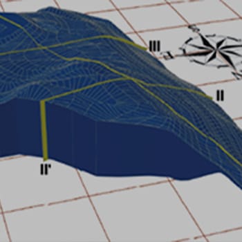
- geohazards (landslides, contamination and pollution of ground),
- mining (determination of the extent and structure of the deposits, risks of rockbursts, discontinuous deformations: landslides, hoppers, sills, voids and karst caverns, deposits of aggregates such as granite, limestone, diabase, dolomite in quarries),
- identification of pollution of land and water for the investment areas such as military & mining areas.
Examples of the application of engineering geophysics…
Additional geophysical services
- advice on the selection of geophysical methods and the scope of work in the field,
- supervision of geophysical surveys,
- verification of performance, processing and interpretation of geophysical surveys commissioned others,
- processing and interpretation of geophysical data.
Geological services
Geological and geotechnical studies allow accurate determination of the parameters of the ground at a particular point. The most commonly used methods of geotechnical surveys are:
- Stability analyses using numerical (Finite Difference Method) and analytical modelling. More…
- geotechnical drillings,
- static and dynamic probing,
- examination of load capacity with dynamic load plate LWD and static load plate VSS – for the purpose of controlling congestion in civil engineering, road, railway water and sanitation,
- macroscopic examination and laboratory identification features: mineralogical and petrographic, physical, mechanical and chemical soil (rock) and groundwater.
GeoSpectrum company performs:
- projects and engineering-geological documentation, including mines and hydrotechnical construction,
- projects and hydrogeological documentation, with the exception of brines, curative and thermal,
- geotechnical documentations,
- reviews and assessments of the geotechnical engineering& geological conditions,
- geological studies,
- geochemical analysis for soils,
- projects intake protection zones of groundwater.
In addition, we offer specialized testing:
- evaluation of the quality of surface and groundwater,
- assessment of the degree of contamination of soil, ground and groundwater,
- the study of industrial waste, including mining (slag, fly ash, sludge),
- study for the content of trace elements and associated.